Copyright ©APK4Share. All Rights Reserved
Download Netherland Topo Maps - v6.3.0
| Package Name | com.atlogis.netherland |
|---|---|
| Category | APPS, Karten & Navigation |
| Latest Version | 6.3.0 |
| Get it On |

|
| Update | December 22, 2020 (4 years ago) |
Es gibt einige APPS so gut wie Lalamove Driver - Earn Extra Income, GPS Emulator Pro APK v1.59 MOD APK, Hammer Truck GPS Navigation App, Maps, & Routes, Jugnoo Drivers, Radarbot (MOD, Premium Entsperrt) MOD APK,
Sygic GPS Navigation & Maps v20.8.12-1769 APK + MOD (Premium Subscription)
MOD APK und Netherland Topo Maps - v6.3.0 auch eine der großen APPS des Genres Karten & Navigation.
Für Netherland Topo Maps - v6.3.0 entwickelt, erfordert Netherland Topo Maps - v6.3.0 mindestens eine Android-Version Android 5.0+. Daher müssen Sie Ihr Telefon bei Bedarf aktualisieren.
Netherland Topo Maps - v6.3.0 APK neueste Version ist 6.3.0, Erscheinungsdatum 2020-12-21 und hat Größe 9.1 MB.
Statistiken zu 1000 -Downloads sind bei Google Play erhältlich. Sie können Apps aktualisieren, die einzeln auf Ihr Android-Gerät heruntergeladen oder installiert wurden, wenn Sie möchten. Durch das Aktualisieren Ihrer Apps erhalten Sie mehr Zugriff auf die neuesten Funktionen und können die Sicherheit verbessern Stabilität der Anwendung.
Da nicht alle Spiele oder Apps für alle Telefone kompatibel sind. Und das Spiel oder die Anwendung für Ihr Gerät nicht verfügbar ist, hängt von der Android-Betriebssystemversion, den Bildschirmauflösungen oder den Ländern ab, auf die Google Play Zugriff gewährt. Bei APK4Share können Sie dies also tun Laden Sie einfach APK-Dateien herunter und unterliegen Sie nicht diesen Einschränkungen.
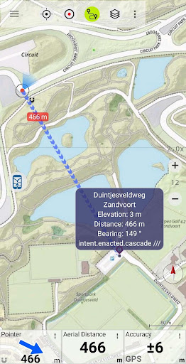
Easy to use Outdoor/Offline GPS navigation app with access to the best topographic maps and satellite images for Netherland.
Turn your Andoid Phone/Tablet into an outdoor GPS for trips into the backcountry WITHOUT CELL COVERAGE. This app gives you similar mapping options as you might know from Garmin or Magellan GPS handhelds.
Included FREE map layers:
• Brtachtergrondkaart from Nationaalgeoregister.nl
• Topo Maps from Nationaalgeoregister.nl
• Orthographic map from Nationaalgeoregister.nl
• OpenStreetMaps : These crowdsourced maps are a very useful addition to other map layers. Contains many unique features.
• OpenCycleMaps: These maps are ideal to plan bicycle trips
• Geological Map (for biologists, geologists, miners, ...)
• ESRI Topographic
• ESRI Aerial Images
• ESRI Street Map
• Google Road Map (online access only)
• Google Satellite Images (online access only)
• Google Terrain Map (online access only)
• Bing Road Map (online access only)
• Bing Satellite Images (online access only)
• Earth At Night
• Hillshading overlay
• OpenSeaMap
Main features for outdoor-navigation:
• Create and edit Waypoints
• GoTo-Waypoint-Navigation
• Track Recording (with speed, elevation and accuracy profile)
• Tripmaster with fields for odometer, average speed, bearing, elevation, etc.
• GPX/KML/KMZ Export
• Search (placenames, POIs, streets)
• Customizable datafields in Map View and Tripmaster (e.g. Speed, Distance, Compass, ...)
• Share Waypoints, Tracks or Routes (via eMail, Whatsapp, Dropbox, Facebook, ..)
• Display coordinates in Lat/Lon, UTM or MGRS/USNG (Military Grid/ US National Grid)
• Record & share tracks with statistics & elevation profile
• Rotate map (Track Up & North Up)
• Get Elevation by long click on map
• Track Replay
• and many more ...
Available Pro features: (Pro features available via In App Purchase)
• Offline Use - no cell coverage needed. No Roaming fees !
• Easy+Fast Bulk-download of map tiles for OFFLINE USAGE (not for Google and Bing maps)
• Create and edit Routes
• Route-Navigation (Point-to-Point Navigation)
• GPX/KML/KMZ Import of Waypoints/Routes/Tracks
• unlimited Waypoints & Tracks
• Add other Map Tile-Server
• No Ads
Offline Use:
All viewed map tiles are kept in cache. To cache large areas you need to purchase Pro features.
Use this navigation app for outdoor activities like hiking, biking, camping, climbing, riding, skiing, canoeing, hunting, offroad 4WD tours or search&rescue (SAR).
Add custom waypoints in longitude/latitude, UTM or MGRS/USNG format with WGS84 datum.
Import/Export/Share GPS-Waypoints/Tracks/Routes in GPX or Google Earth KML/KMZ format.
Preload FREE map data for areas without cell service (Pro feature !).
Comments and feature requests to [email protected]
Have a look at our other outdoor navigation apps: https://play.google.com/store/search?q=atlogis
+++ We DO NOT track any user activities or collect any user data ! +++
• Improvements & Fixes
Show more