Copyright ©APK4Share. All Rights Reserved
Download TouchTrails - Route Planner, GPX Viewer/Editor - v2.2.1
| Package Name | com.wolfgangknecht.sketchatrack |
|---|---|
| Category | APPS, Karten & Navigation |
| Latest Version | 2.2.1 |
| Get it On |

|
| Update | November 18, 2020 (5 years ago) |
Es gibt einige APPS so gut wie Circuit Route Planner, Locus Map Pro Outdoor GPS navigation and maps APK Paid MOD APK, Hammer Truck GPS Navigation App, Maps, & Routes, Bykea Partner, Jugnoo Drivers, Wikiloc Outdoor Navigation GPS Premium APK MOD APK und TouchTrails - Route Planner, GPX Viewer/Editor - v2.2.1 auch eine der großen APPS des Genres Karten & Navigation.
Für TouchTrails - Route Planner, GPX Viewer/Editor - v2.2.1 entwickelt, erfordert TouchTrails - Route Planner, GPX Viewer/Editor - v2.2.1 mindestens eine Android-Version Android 5.0+. Daher müssen Sie Ihr Telefon bei Bedarf aktualisieren.
TouchTrails - Route Planner, GPX Viewer/Editor - v2.2.1 APK neueste Version ist 2.2.1, Erscheinungsdatum 2020-11-17 und hat Größe 17.1 MB.
Statistiken zu 1000 -Downloads sind bei Google Play erhältlich. Sie können Apps aktualisieren, die einzeln auf Ihr Android-Gerät heruntergeladen oder installiert wurden, wenn Sie möchten. Durch das Aktualisieren Ihrer Apps erhalten Sie mehr Zugriff auf die neuesten Funktionen und können die Sicherheit verbessern Stabilität der Anwendung.
Da nicht alle Spiele oder Apps für alle Telefone kompatibel sind. Und das Spiel oder die Anwendung für Ihr Gerät nicht verfügbar ist, hängt von der Android-Betriebssystemversion, den Bildschirmauflösungen oder den Ländern ab, auf die Google Play Zugriff gewährt. Bei APK4Share können Sie dies also tun Laden Sie einfach APK-Dateien herunter und unterliegen Sie nicht diesen Einschränkungen.
TouchTrails is an easy to use route planner. Measure the distance of your last running activity or explore the elevation profile of the next bike tour you are planning to do. Just draw it on the map and get the information you're looking for.
TouchTrails is the perfect route planner for all kind of outdoor activities, including:
• Hiking
• Cycling
• Mountain Bike
• Running
• Walking
• Mantrailing
With this route planner you can simply draw routes with your finger on the map. Get distance information and elevation profiles even for the smallest footpaths and trails in the backcountry.
You can split tracks, erase parts of a track or connect routes. Export your routes as GPX, share them and open them wherever you want to.
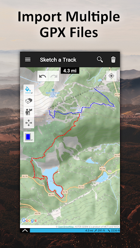
GPX Viewer
You can also use TouchTrails as a simple GPX viewer. Import gpx files for your hiking tour or whatever outdoor activity you plan to do. Multiple routes will be displayed in different colors. Measure distances and view elevation profiles.
Features
• Route planner - draw routes with finger
• GPX Viewer - import GPX files
• Explore elevation profiles
• Calculate distances
• Manage and merge multiple routes
Pro Features
• Save as many tracks as you want
• Export gpx files
• Generate offline maps for your backcountry trip
Install TouchTrails–the route planner at your fingertip–to plan your next hiking or mountain bike tour on a small footpath in the backcountry now ?.
• New map provider: faster and more reliable maps
Show more