Copyright ©APK4Share. All Rights Reserved
İndir 2GIS: Offline map & Navigation - v5.49.1.383.19
| Package Name | ru.dublgis.dgismobile |
|---|---|
| Category | Uygulamalar, Haritalar ve Navigasyon |
| Latest Version | 5.49.1.383.19 |
| Get it On |

|
| Update | October 29, 2021 (3 years ago) |
Uygulamalar Circuit Route Planner, Relief Maps - 3D GPS Hiking | Trail Running | Ski, Jugnoo Drivers, Radarbot (MOD, Premium Kilitli) MOD APK, Hammer Truck GPS Navigation App, Maps, & Routes, Bykea Partner kadar iyi ve 2GIS: Offline map & Navigation - v5.49.1.383.19 türün en iyilerinden Uygulamalar biri Haritalar ve Navigasyon var.
DoubleGIS, LLC tarafından geliştirilmiştir, 2GIS: Offline map & Navigation - v5.49.1.383.19 en az Android sürümünü gerektirir Android 6.0+. Bu nedenle, gerekirse telefonunuzu güncellemelisiniz.
2GIS: Offline map & Navigation - v5.49.1.383.19 APK en son sürüm 5.49.1.383.19, yayın tarihi 2021-10-29 ve boyutu 98.7 MB.
İndirmelerle ilgili 1000 istatistiklere Google Play'den ulaşabilirsiniz. Android cihazınıza tek tek indirilmiş veya yüklenmiş uygulamaları güncelleyebilirsiniz. Uygulamalarınızı güncellemek size en yeni özelliklere daha fazla erişim sağlar ve güvenliği ve uygulamanın kararlılığı.
Çünkü tüm oyunlar veya uygulamalar tüm telefonlar için uyumlu değildir. Ve oyun veya uygulama cihazınız için kullanılamaz, bu Android işletim sistemi sürümüne, ekran çözünürlüklerine veya Google Play'in erişime izin verdiği ülkelere bağlıdır. Yani APK4Share'de şunları yapabilirsiniz APK dosyalarını kolayca indirin ve bu kısıtlamalara tabi olmayın.
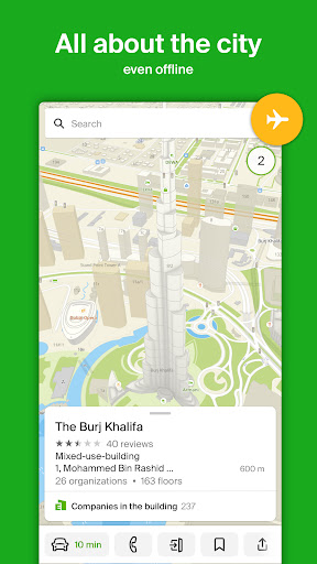
2GIS is a directory with a map and navigator. The application works without Internet connection — download the city database and use it on the plane, subway, or when in a roaming zone.
SERVICES, ADDRESSES, AND COMPANIES
2GIS knows which provider operates in your house, where there is a district hospital or a post office. Will help you to choose a cafe or a service center by reviews and photos. Will show the opening hours and the telephone number.
TRANSPORT AND NAVIGATION
If you are driving, 2GIS will guide you along the road and warn you about the maneuvers using the voice instructions. Will take traffic jams and blocked streets into account. Will update the route if you deviate from your way. For pedestrians, it will find the options of going by buses, metro, trains, cable cars and river trams.
BUILDING ENTRANCES
In order not to look for an entrance to a business center you need, look in 2GIS. The application knows how to enter into 2.5 million companies. If you are looking for route directions for public transport or a car, 2GIS will show the way to the very door.
PLANS OF SHOPPING CENTRES
2GIS helps to navigate inside shopping centers. Shows everything: from shops and cafes to ATMs and toilets. Find places in advance to save time.
CITIES OF THE UAE, CYPRUS, THE CZECH REPUBLIC, CHILE
Dubai, Limassol, Nicosia, Padua, Prague (Praha), Santiago.
CITIES OF RUSSIA
Moscow, Saint Petersburg, Novosibirsk, Ekaterinburg, Krasnoyarsk, Chelyabinsk, Ufa, Omsk, Kazan, Perm and much more! See the full list: https://2gis.ru/countries/global/
CITIES OF UKRAINE, KAZAKHSTAN AND KYRGYZSTAN
Almaty, Nur-Sultan, Kiev, Bishkek and much more.
SOCIAL NETWORKS
Facebook — http://facebook.com/2GISUAE
VKontakte — https://vk.com/2gis
Twitter — http://twitter.com/2gis
Technical support — [email protected]
Breaking news: we have completely revamped the car navigator! Brand new design, a mini-map of the route, parking lots on the map, travel time and arrival time displayed together. Also, we made a lot of algorithm improvements. Go to the application settings, select "Navigator", and turn on the new 2GIS navigator. And don't forget to share your opinion on the update.
Show moreOTHER VERSIONS
- 2GIS: Offline map & Navigation - v5.49.0.382.28
- 2GIS: Offline map & Navigation - v5.49.0.381.20
- 2GIS: Offline map & Navigation - v5.49.0.380.17
- 2GIS: Offline map & Navigation - v5.47.2.371.4
- 2GIS: Offline map & Navigation - v5.46.0.366.10
- 2GIS: Offline map & Navigation - v5.0.8.297.13
- 2GIS: Offline map & Navigation - v5.0.2.276.18
- 2GIS: Offline map & Navigation - v4.3.9.2453
- 2GIS: Offline map & Navigation - v4.3.10.2481
RELATED