Copyright ©APK4Share. All Rights Reserved
Tải về LK8000 Beta - v7.2
| Package Name | org.lk8000.test |
|---|---|
| Category | Ứng dụng, Bản đồ & Dẫn đường |
| Latest Version | 7.2 |
| Get it On |

|
| Update | December 23, 2020 (4 years ago) |
Có khá nhiều Ứng dụng hay như
Sygic GPS Navigation & Maps v20.8.12-1769 APK + MOD (Premium Subscription)
MOD APK, Locus Map Pro Outdoor GPS navigation and maps APK Paid MOD APK, GPS Emulator Pro APK v1.59 MOD APK, Bykea Partner, Radarbot (MOD, Premium Đã mở khóa) MOD APK, Relief Maps - 3D GPS Hiking | Trail Running | Ski, và LK8000 Beta - v7.2 cũng vậy, một trong những Ứng dụng tuyệt vời của thể loại Bản đồ & Dẫn đường.
Phát triển bởi LK8000 Tactical Flight Navigator, LK8000 Beta - v7.2 cần bản Android tối thiểu là Android 4.1+. Do đó bạn phải cập nhật điện thoại của mình nếu cần thiết.
LK8000 Beta - v7.2 APK phiên bản mới nhất là 7.2, ngày phát hành 2020-12-22, và có dung lượng 18.5 MB.
Thống kê có khoảng 1000 lượt tải được từ Google Play. Bạn có thể cập nhật các ứng dụng đã được tải xuống hoặc cài riêng lẻ trên thiết bị Android nếu bạn muốn. Cập nhật ứng dụng của bạn cung cấp cho bạn quyền truy cập vào các tính năng mới nhất và cải thiện tính bảo mật và ổn định của ứng dụng.
Bởi vì không phải trò chơi hoặc ứng dụng nào cũng tương thích cho tất cả các điện thoại. Và trò chơi hoặc ứng dụng đôi khi không khả dụng với thiết bị của bạn, nó phụ thuộc vào phiên bản hệ điều hành Android, độ phân giải màn hình hoặc các quốc gia mà Google Play cho phép truy cập. Vậy nên tại APK4Share bạn có thể dễ dàng tải xuống các file APK và không dính vào các hạn chế này.
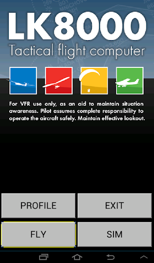
This is the beta testing version of LK8000.
LK8000 is a Tactical Flight Navigator for gliders, paragliders, hang-gliders and general aviation. It is a consolidated open-source project born in 2010, available on most platforms: PC, PNA, KOBO, LINUX, IOS (under development), RASPBERRY and ANDROID. LK is translated into 17 languages and used in over 67 countries by many thousands pilots every day.
LK can be configured to act as a navigator for free flight (gliding, paragliding, hang-gliding), for light aircraft (general aviation), and also for trekking and offroad! On our website you can download the necessary maps for your country, together with documentation, hints, tutorials and news. We also offer free support to all users on our international support forum (upon free subscription). Maps can also be downloaded from LK configuration using LKMAPS app.
In addition to classic flight navigation functions, LK has many advanced features:
- Detection of start of free flight (both towing and winching)
- Accurate calculations of scoring, due to the above feature
- Forecasting for completion of FAI triangles, with virtual waypoint created dinamically and available for a "go-to"
- The Oracle, a no-panic instant page giving accurate position report for a quick readout on the radio
- A super complete automatic logbook, both for reading on the device and for export as CSV for spreadsheets.
- A clever profile system allowing saving and loading setting for device, pilot, system and aircraft
- Textual pages for waypoints, airports, airspaces, in a format similar to the one in use by professional avionics
- A super aggressive FLARM data management, with "link to target" functionalities, radar with history of traces and more. It is the most advanced FLARM data management available worldwide in terms of capabilities.
- Cross-section map pages with splittable sections (top and side view)
- An innovative "visual glide" page, suggesting all reasonable choices for long glides around with no need to touch anything, totally automatic: just feed LK with data (waypoints) about mountain peaks, valleys, ridges.
- Airspace warning sonar: approaching to airspaces can be signalled with a sonar-style approach, no need to look at the screen
- Automatic MacCready calculation (AutoMC): let us tell you how things are really going, and calculate arrival altitudes not around what you hope, but what you are really doing.
- Automatic radio frequency setup, no need to touch the radio anymore (for supported hardware)
- Multi targets: change destination with a single touch of the screen corner, rotating among current task waypoint, best alternate (calculated automatically of course), Home, Last good thermal, Team mate, Flarm target.
- Textual list and selection of all of your thermals, for a prompt go-to, automatically named after their timestamp, with distance and direction from you, historic climb average and forecasted arrival altitude at the bottom of the thermal, all sortable, and ready for a go-to .
.. and much much more.
Watchout, LK8000 has been carefully designed for a turbulence proof usage during flight. It is trivial to use it, but not immediate without knowing how it works. Once you know it, you never leave it.
Feed LK with waypoints. On ancient hardware, we made LK capable to handle as much as 10 thousands waypoints at once. On modern systems, it would be a pity not to make use of hardware speed. If you fly in mountain areas, look after a waypoint list of peaks, valleys, ridges, thermal spots, and let LK use them for you. You will be amazed for what appears automatically on the multimap page "Visual glide" once there's some data to munch!
What you get, is the most advanced free flight computer ever made. Welcome aboard!
- fix segfault in TRI page with some language- fix BlueFLyVario driver
Show more